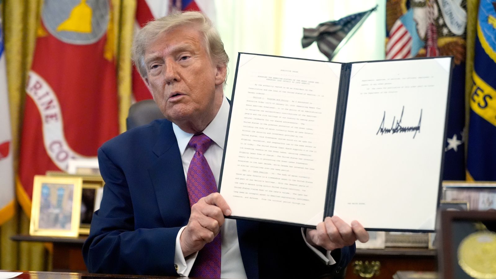
When the Oval Office announced that Lake Ontario would henceforth be known within American federal jurisdiction as Lake America, the declaration was treated by many pundits as another theatrical salvo in an ongoing trade war. President Donald Trump signed an executive order targeting the shared freshwater basin, framing the hydronymic shift as retaliation against Canadian trade policies and stiff retaliatory tariffs. Yet dismissing this move as mere political pageantry misses the structural reality of modern digital geography. Cartography has become an explicit instrument of statecraft, economic pressure, and informational dominance.
The immediate backdrop involves a rapidly deteriorating bilateral economic relationship. Following the collapse of recent trade negotiations, Washington levied a fifty percent tariff on approximately twenty billion dollars worth of Canadian exports, spanning dairy, whisky, toys, and iconic cultural items like hockey sticks. Ottawa responded in kind, scheduling dollar-for-dollar retaliatory tariffs on hundreds of American goods. Within this high-stakes standoff, the decision to rename a major international body of water serves a specific psychological and bureaucratic function. It alters federal mapping databases, forces domestic agencies to update geographic information systems, and creates an immediate compliance headache for federal contractors and mapmakers.
Sovereignty over a shared natural resource does not grant unilateral authority to rename it on international maps, but domestic compliance mechanisms carry real weight. Federal agencies under the executive branch must update internal documentation, maritime navigation logs, and official federal publications to reflect the new designation. This mirrors the precedent set when the administration attempted to relabel the Gulf of Mexico as the Gulf of America. In that instance, major technology platforms adopted segmented mapping strategies, displaying different names depending on the user's geographic jurisdiction, while institutional style guides fractured along ideological and national lines.
Canadian leadership swiftly rejected the executive order. Prime Minister Mark Carney emphasized the deep indigenous Iroquoian roots of the name Ontario, which translates to a descriptor of a large and beautiful lake. Ottawa made it clear that reality on the ground, and on Canadian charts, remains entirely unchanged. Provincial pushback inside the United States was equally immediate. New York Governor Kathy Hochul publicly rejected the federal designation, noting that the state government and local economies dependent on cross-border commerce have no intention of adopting the moniker. When agricultural exporters in upstate New York are worried about selling apples across the border, local municipal and state authorities find themselves mediating the friction caused by federal grandstanding.
The mechanics of geographic naming rights involve a fractured ecosystem of domestic authorities, international bodies, and private cartographic corporations. The United States Board on Geographic Names typically standardizes names for federal use, but states retain independent authority over their own territories. More importantly, global navigation and consumer mapping applications are driven by commercial entities that must navigate conflicting legal requirements and market sensitivities. If a commercial mapping provider chooses to display Lake America for users inside the United States while retaining Lake Ontario for Canadian users, it institutionalizes a fractured digital reality.
This digital fragmentation transforms everyday software into an active theater of geopolitical friction. For decades, geographic data was viewed as a neutral baseline, a shared template upon which human commerce and travel were plotted. When states begin weaponizing nomenclature, that neutral baseline evaporates. Corporations caught in the middle face difficult choices regarding compliance, brand localization, and user trust. A map is no longer just a way to find a route; it is a legal and political declaration of allegiance.
As the September implementation date for new reciprocal tariffs approaches, the standoff over the lake highlights the limits of executive power in an interconnected commercial ecosystem. Washington can mandate what appears on a National Park Service sign or a federal database, but it cannot compel international recognition or force sovereign neighbors to rewrite their language. The water flows across the international boundary regardless of what the federal register calls it, carrying billions in trade and binding two economies that cannot decouple despite the political theater playing out along their shores.
Trump renames Lake Ontario as Lake America amid Canada trade war
Al Jazeera's reporting from Washington details the immediate diplomatic fallout and the mechanics behind the executive order renaming the shared waterway.
http://googleusercontent.com/youtube_content/1


