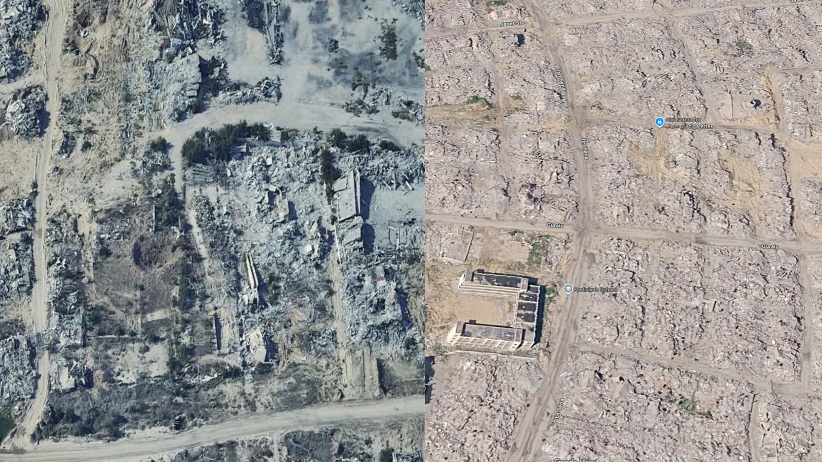
Orbiting hundreds of miles above the earth, commercial and reconnaissance satellites do more than track weather patterns or borders. They serve as indifferent witnesses to human devastation. Over nearly three years of relentless conflict between Israel and Hamas, the strip of land along the eastern Mediterranean has undergone a transformation so radical that orbital imaging offers a stark, unyielding ledger of destruction. When high-resolution pixels capture neighborhoods reduced to pulverized gray flour, the imagery strips away political spin and propaganda, leaving behind a cold geometry of loss.
To understand the scope of what has occurred since late 2023, one must look past the daily casualty figures and examine the systematic dismantling of an entire ecosystem. Analysts poring over optical and synthetic aperture radar data note that the urban fabric of the enclave has experienced a level of structural compromise rarely seen in modern warfare. Entire municipal grids have vanished. Where apartment complexes, universities, and bustling commercial corridors once stood, temporal sequences of satellite frames show flat, uniform expanses of debris.
The Mechanics of Urban Erasure
Modern conflict in densely populated zones relies heavily on air power and heavy artillery, resulting in a predictable architectural outcome. What distinguishes the ongoing war is the sheer velocity and concentration of the destruction. Geospatial intelligence experts using automated damage assessment algorithms have tracked the collapse of critical infrastructure block by block. Hospitals, water treatment plants, and agricultural greenhouses have not merely been damaged; they have been systematically leveled, effectively resetting the physical development of the territory by decades.
Consider the northern governorates. In the early months of the hostilities, orbital photography captured the initial wave of structural impacts—punctured roofs, collapsed façades, and severed arterial roads. By the second year, those same coordinates revealed total obliteration. Entire districts were flattened into pulverized particulate matter, erasing property boundaries, street names, and the landmarks that defined generations of community life. This is not collateral damage in the traditional sense. It is the fundamental reconfiguration of geographic space through kinetic force.
Beyond the Concrete
The physical destruction visible from space tells only half the story. Beneath the satellite view lies an environmental and humanitarian crisis that defies easy quantification. The pulverization of millions of tons of concrete releases hazardous particulates, asbestos, and heavy metals into the atmosphere and the shallow coastal aquifer. Sewage treatment facilities, crippled early in the conflict, have forced raw effluent into the sea and onto the streets, creating public health hazards that will linger long after the guns fall silent.
Agriculture has suffered an equivalent fate. Greenhouses, orchards, and irrigation networks visible in pre-war archives have been churned into mud tracks and military staging grounds. The arable topsoil, heavily compacted by armored vehicles and contaminated by unexploded ordnance, presents a formidable barrier to future food security. Even if every combatant laid down their arms tomorrow, the physical substrate of daily survival has been profoundly compromised.
The Limits of Orbital Witness
While satellites provide undeniable proof of structural collapse, they possess inherent limitations. They cannot capture the human psychological toll, the whispers of displaced families sheltering in makeshift tents among the ruins, or the precise nature of the subsurface infrastructure—the extensive tunnel networks—that drove the military strategy in the first place. Orbital imagery provides the macro view, a high-altitude abstraction of a human catastrophe. It measures destruction in square kilometers and spectral signatures, reducing lived experiences to pixels on a screen.
Yet, this cold documentation remains essential. As legal scholars, human rights investigators, and historians prepare for the arduous task of accountability and future reconstruction, these orbital archives serve as an unalterable record. They prevent denial, bypass rhetoric, and document a transformation of territory so absolute that the landscape of the future will bear almost no resemblance to the past. The satellites continue their silent orbits, capturing each successive frame of a tragedy written in dust and shadow.