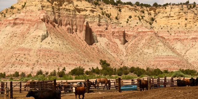
The federal government stripped protection from millions of acres of public land in Utah not out of a sudden obsession with conservation philosophy, but to clear a path for corporate extraction. When Donald Trump signed executive orders slashing Bears Ears National Monument by 85 percent and Grand Staircase-Escalante by nearly half, it represented the largest single reversal of land preservation in American history. While early reports framed this purely as a political culture war, the underlying reality is driven by mineral rights, energy infrastructure, and decades of quiet corporate lobbying.
This was a calculated economic realignment.
To understand how these specific borders shrank, you have to look below the topsoil. Publicly, the administration argued that previous presidents had abused the Antiquities Act of 1906, overreaching by locking up vast swaths of land that local communities needed for economic survival. Ranchers wanted grazing rights, and local politicians wanted state control. But internal mapping data and geological surveys tell a far more transactional story.
The Subterranean Maps That Rewrote Public Borders
National monuments are not drawn at random. Neither are their deletions. When the boundaries of Bears Ears and Grand Staircase-Escalante were redrawn, the newly excluded areas mapped almost perfectly onto known deposits of oil, gas, and high-grade coal.
Consider the Kaiparowits Plateau, a massive, rugged tableland buried inside the original boundaries of Grand Staircase-Escalante. Geological estimates suggest the plateau holds one of the largest untapped coal deposits in the United States—potentially billions of tons of low-sulfur coal. For over two decades, energy companies viewed the monument designation as a federal padlock on a fortune. By slicing the monument in half, the government effectively handed the key back to industry players.
A similar pattern emerged in Bears Ears. The original monument boundary, established in 2016, sat directly adjacent to actively producing oil and gas fields in the Paradox Basin. Uranium producers also held a vested interest. An internal push by mining executives targeted specific sections of the monument known to contain uranium deposits, lobbying federal officials to alter the lines so that existing claims could be developed without federal oversight.
The Lobbying Trail
The changes did not happen in a vacuum. Mining and energy firms spent millions in the years leading up to the decision, targeting both the Department of the Interior and state lawmakers.
- Uranium Producers: Companies with claims just outside or inside the original boundaries explicitly petitioned the government, noting that federal protections restricted their access to processing facilities and potential ore bodies.
- Oil and Gas Consortia: Industry trade groups filed extensive comments arguing that the vast scale of the monuments barred modern directional drilling techniques, which could otherwise tap resources beneath the protected zones.
- State Political Access: Utah officials aligned with extraction industries worked hand-in-hand with federal mapmakers, ensuring that state-leased lands trapped inside federal boundaries were freed up for commercial development.
The Legal Fiction of the Antiquities Act
The entire executive action rests on a fragile legal premise. The Antiquities Act gives the president the power to declare national monuments to protect "historic landmarks, historic and prehistoric structures, and other objects of historic or scientific interest." It explicitly states these reservations must be confined to the "smallest area compatible with the proper care and management of the objects to be protected."
The administration used this "smallest area" clause as a crowbar. They argued that hundreds of thousands of acres of sagebrush and canyon did not qualify as distinct objects of historic interest.
However, the law says nothing about a president’s power to reduce or abolish a monument once created.
This omission is the core of the legal battle waged by Native American tribes and environmental coalitions. Historically, when past presidents modified monument boundaries, the changes were minor adjustments to correct mapping errors or accommodate local infrastructure. Never before had millions of acres been removed in a single stroke. By treating the statute as an elastic band that can be stretched or cut at will, the administration set a precedent that threatens the permanence of every national monument in the country.
Native Sovereignty and the Erasure of Cultural Landscape
For the coalition of tribes that fought for the creation of Bears Ears—including the Navajo, Hopi, Zuni, Ute Mountain Ute, and Ute Indian Tribe—the downsizing was a direct assault on tribal sovereignty. The area is not a vacant wilderness; it is an active cultural landscape containing hundreds of thousands of sacred sites, ancestral dwellings, and burial grounds.
When the boundaries shrank, thousands of these documented archaeological sites lost their enhanced federal protection overnight. They were relegated back to standard Bureau of Land Management rules, which allow for mineral leasing, motorized vehicle access, and far less stringent monitoring.
The defense of these lands was never about keeping people out. It was about preventing the physical destruction of history. When heavy machinery moves in to build roads, drill pads, and pipelines, the context of an archaeological site is obliterated forever. A cliff dwelling isolated by an oil well loses its cultural integrity, even if the stones themselves remain untouched.
The Economic Mirage of Rural Revitalization
Proponents of the cuts promised an economic boom for rural Utah counties. They painted a picture of revived mining towns, high-paying energy jobs, and booming local tax bases.
That boom largely failed to materialize, exposing a fundamental misunderstanding of modern commodity markets.
Global energy markets, not federal land designations, dictate whether a company will invest hundreds of millions of dollars into new infrastructure. The coal buried beneath the Kaiparowits Plateau is expensive to extract and even more expensive to transport to distant markets, especially at a time when power plants are retiring coal units in favor of cheaper natural gas and renewables. No major mining conglomerate rushed to build a massive new coal mine just because the boundary moved.
Similarly, uranium mining faces stiff competition from cheaper overseas operations in countries like Kazakhstan and Canada. Opening up public lands did not suddenly make domestic uranium extraction highly profitable; it merely shifted the speculative value of the land.
Meanwhile, the local economies had already transitioned. Towns like Escalante and Moab built robust service economies centered around outdoor recreation, tourism, and retirement. Hotel owners, river guides, and local restaurateurs viewed the monument downsizing as a direct threat to their livelihoods. By prioritizing highly volatile, boom-and-bust extraction industries over a stable, growing recreation economy, state and federal leaders gambled with the financial stability of the very communities they claimed to protect.
The Permanent Cost of Fragmented Ecosystems
Ecosystems do not respect lines drawn on a political map. When you cut a protected area into isolated islands of wilderness surrounded by industrial zones, you destroy the ecological integrity of the entire region.
Wildlife corridors are the first casualties. Species like the desert bighorn sheep, mule deer, and pronghorn rely on vast, unbroken stretches of land to migrate between seasonal feeding grounds. When an area is fragmented by roads, fencing, and drilling rigs, populations become isolated, gene pools shrink, and species decline.
Dust is another compounding factor. Increased industrial traffic and soil disturbance on unprotected lands release massive quantities of fine dust into the atmosphere. Prevailing winds carry this dust east, depositing it onto the snowpacks of the Rocky Mountains. Dark snow absorbs more sunlight than clean snow, melting weeks earlier than normal and disrupting the entire water cycle of the American West, accelerating spring runoff and worsening late-summer droughts.
The illusion that you can mine one acre and perfectly preserve the acre next to it is shattered by the realities of landscape-scale ecology. The damage cannot be neatly contained within the zones approved for lease.
The battle over the Utah monuments is not a localized dispute over desert acreage. It is a blueprint for how public assets are systematically devalued, dismantled, and transferred to private balance sheets under the guise of regulatory reform.