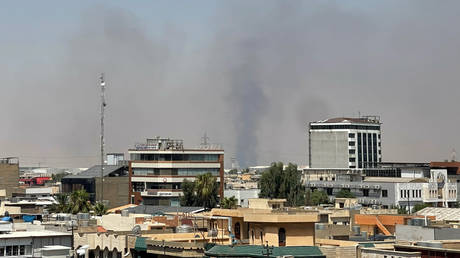
Mass civilian evacuations across Southwestern Europe are not merely responses to seasonal brushfires; they represent structural supply chain failures in wildland-urban interface (WUI) suppression, fuel load management, and disaster response logistics. When tens of thousands of residents and tourists are displaced simultaneously across southwestern France and central Spain, treating the incident as a sudden act of nature masks the systematic vulnerability built into Southern European land management over decades.
The operational crisis unfolding across Gironde, the Cap Ferret peninsula, and the Autonomous Community of Madrid can be deconstructed into three interdependent systems: fuel-bed dynamics, atmospheric feedback loops, and response capability bottlenecks.
Fuel Dynamics and Land Abuse Economics
The rapid velocity of flame fronts across the Landes forest and the Iberian plateau stems directly from two historical shifts: structural rural depopulation and industrial monoculture forestry.
Rural abandonment across central Spain has eliminated traditional agrarian pressure points—namely livestock grazing and underbrush foraging—that historically kept floor-level fuel loads below critical ignition thresholds. Unmanaged brush continuously accumulates high volatile-oil biomass. In parallel, Southwestern France’s reliance on dense Maritime Pine (Pinus pinaster) plantations creates continuous canopy layers.
The ignition equation functions across three measurable variables:
- Fuel Moisture Content (FMC): Extended spring and summer heatwaves drive living plant foliage below the critical 10% moisture threshold. At this point, forest canopy shifts from heat absorber to rapid accelerant.
- Volatile Organic Compound (VOC) Emissions: High heat causes pine species to off-gas terpenes. This creates localized gas-phase flammability pockets that ignite ahead of the main fire line via thermal radiation.
- Horizontal and Vertical Continuity: Dense plantation geometry provides uninterrupted ladder fuels, allowing ground fires to transition into high-velocity crown fires within minutes.
When continuous fuel beds interact with a high Vapor Pressure Deficit (VPD), the rate of spread scales non-linearly. The result is the current operational failure: fire fronts advancing faster than mechanized fire suppression teams can establish physical control lines.
Atmospheric Feedback and Convective Fire Behavior
Wildfires of this scale cease to be passive weather-dependent events; they actively generate localized microclimates that bypass conventional containment strategy. As flame temperatures exceed 1,000°C, extreme convective columns force rapid air displacement.
This dynamic manifests through distinct physical mechanisms:
- Pyrocumulonimbus Generation: Intense heat lifts huge volumes of moisture and ash into the upper troposphere. As this air column cools and collapses, it creates localized, hyper-localized downbursts that drive spot fires up to several kilometers ahead of the main perimeter.
- Indraft Acceleration: The massive thermal updraft draws ambient air inward at ground level, creating localized gale-force surface winds. These winds deliver continuous oxygen to the combustion zone regardless of regional synoptic weather patterns.
- Radiation-Convection Coupling: Heat transfer shifts from direct conduction to radiative radiant heat, desiccating target fuel beds tens of meters ahead of the physical flame front.
Emergency aerial units relying on Canadair amphibious water bombers or heavy helicopters face severe operational constraints under these conditions. Thermal turbulence limits safe drop altitudes, while low visibility from dense particulate smoke prevents precision targeting of active fire heads. Water drops in high-convective environments frequently evaporate before hitting the canopy, reducing suppressing impact.
Systemic Failure Points in Urban-Interface Logistics
Evacuating tens of thousands of people from coastal bottlenecks like the Cap Ferret peninsula exposes critical flaws in civil protection architecture. Mass displacement is a symptom of containment breakdown, forcing authorities to pivot from suppression to survival logistics.
The bottleneck exists in single-access infrastructure. Coastal and mountain tourist destinations rely heavily on limited secondary road networks. When a high-velocity wildfire intersects a primary transport corridor, the evacuation vector is destroyed. The deployment of maritime shuttles to evacuate civilians off piers highlights a total compromise of terrestrial escape routes.
The civil response bottleneck follows a predictable failure curve:
- Information Disruption: Early evacuation warnings rely on cellular networks and local authorities. Rapidly moving fire fronts regularly compromise localized telecommunications infrastructure, delaying broadcast alerts.
- Resource Inversion: Firefighters are diverted from tactical flank containment to defensive asset protection around isolated structures. This allows the main fire head to move unchecked.
- Interoperability Deficits: Cross-border deployments coordinated through the European Union Civil Protection Mechanism require standardized tactical procedures, radio frequencies, and command structures. While aerial units from partner nations provide raw volume, integrating foreign assets into rapidly evolving local command structures introduces operational latency during the critical early hours of escalation.
National declarations of emergency, such as those triggered in Madrid and Avila, represent the institutional acknowledgment that regional emergency assets are fully depleted.
Strategic Action Plan for Regional Wildfire Mitigation
To prevent recurring, systemic operational failures across Southern Europe, municipal and national defense authorities must abandon reactive suppression models in favor of hard tactical engineering.
First, transition forestry subsidies away from clear-cut commercial softwood monocultures toward strategic, fire-resistant hardwood buffer zones around high-density urban-interface nodes. Managed native vegetation breaks the vertical ladder-fuel continuity required for severe crown fires.
Second, integrate predictive real-time synthetic aperture radar (SAR) and autonomous infrared drone swarms directly into unified incident command systems. Suppressing ignitions within the first 20 minutes before convective column formation remains the only operationally viable mechanism to prevent multi-municipality emergency evacuations.
Third, mandate legally enforced defensible space buffer zones around all private properties situated within high-risk wildland-urban interface zones. Properties failing to maintain clear, low-biomass zones within 50 meters of structural foundations should face automatic municipal remediation funded through property tax levies.